Houston sits on roughly 50 feet of Quaternary alluvial deposits over the Beaumont Formation, a clay-rich layer that complicates deep excavation planning. The city's flat topography and high water table make subsurface surprises common. A GPR (Ground Penetrating Radar) survey provides real-time imaging of buried utilities, voids, and soil anomalies without drilling. We integrate this non-invasive technique early in the design phase to avoid costly rework. Before any concrete pour or trench cut, our team scans the area to map rebar, post-tension cables, and underground storage tanks. This data pairs well with a capacidad de carga study for foundation verification, especially on sites with variable fill layers.
A properly executed GPR survey in Houston can locate buried utilities down to 10 feet, reducing excavation risk by over 60% in congested urban sites.
Methodology and scope
Houston's humid subtropical climate means clay soils expand and contract significantly with moisture, creating differential movement that can crack slabs and pavements. GPR survey helps locate these problem zones before construction. The method uses high-frequency electromagnetic pulses — typically 250 MHz to 1.6 GHz — to penetrate up to 10 feet in conductive clay. We calibrate the antenna to local soil conditions, adjusting frequency and gain for optimal resolution. For deeper targets or areas with high clay content, we supplement with ensayo CPT for continuous soil profiling. Our process follows ASTM D6432-19 for standard guide for using the subsurface GPR method. Key parameters recorded include:
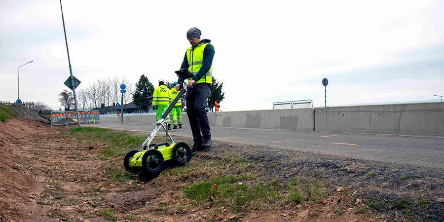
Technical reference image — Houston
Local considerations
A common mistake we see on Houston job sites is relying solely on utility mark-outs from 811. These locate only public lines, leaving private conduits, old foundations, and abandoned septic tanks undetected. Hitting an unmarked high-voltage line or a 6-inch gas main can shut a project down for weeks. GPR survey fills that gap, identifying metallic and non-metallic targets down to 10 feet. We also flag anomalous reflections that may indicate sinkholes or soft zones, especially near the Buffalo Bayou corridor where old stream channels create unpredictable ground conditions.
Locate and mark all buried utilities — water, gas, electric, telecom, and irrigation lines — before any excavation. We use dual-frequency antennas to detect both metallic and PVC pipes. Deliverable includes a scaled plan view with depth annotations.
02
Concrete Scanning and Rebar Mapping
Scan slabs, walls, and bridge decks to map rebar spacing, cover depth, and post-tension cables. Ideal for core drilling, saw cutting, or retrofitting. Our 1.6 GHz antenna resolves rebar down to 1.5-inch spacing. Report includes 2D profiles and 3D grid overlays.
Applicable standards
ASTM D6432-19 – Standard Guide for Using the Surface GPR Method, ASTM D4748-10 – Standard Test Method for Determining the Thickness of Bound Pavement Layers Using GPR, OSHA 29 CFR 1926.651 – Excavation and Trenching Safety (utility location compliance)
Frequently asked questions
How deep can GPR penetrate in Houston's clay soils?
In typical Houston clay with moderate moisture, a 250 MHz antenna reaches about 8–10 feet. Higher frequencies (400 MHz and up) give better resolution but less depth. We always run a calibration scan on site to confirm maximum penetration for your specific soil conditions.
Can GPR detect plastic pipes and fiber optic lines?
Yes, but the signal strength depends on the contrast between the pipe material and surrounding soil. Water-filled plastic pipes show up well. Dry conduits can be harder to image. We use a combination of 250 MHz and 400 MHz antennas to maximize detection of non-metallic targets.
What is the cost range for a GPR survey in Houston?
For a typical residential or small commercial lot (up to 10,000 sq ft), expect between $1,250 and $2,500. Larger sites or complex utility grids run $3,500–$9,550. Final price depends on site size, number of target lines, and required depth of investigation. We provide a fixed quote after a brief site review.
How do you handle GPR data in areas with high groundwater?
High groundwater attenuates the radar signal, reducing depth. We compensate by using lower frequencies (250 MHz) and increasing gain. In saturated clays near the Gulf Coast, we often combine GPR with a complementary method like electrical resistivity or CPT to confirm deep targets. Our reports clearly note any depth limitations due to moisture.
Location and service area
We serve projects across Houston and its metropolitan area.